


 16 / 28

 www.SullivansIslandMagazine.com
|
www.SullivansIslandHomes.com|
www.SullivansIsland.co14
unusual hillside residences. The hills were man-made and
served as military bunkers. In fact, the streets where they
are situated weren’t even in existence when the installation
was in use. In those days, all residential streets ended at
Station 28½. Brownell, Harvey and Marshall streets were
added when the property was sold to private developers
after the war.
The reservation came under the military jurisdiction
of Fort Moultrie, and, because the fort’s 200 acres were
crowded with buildings and personnel, Marshall Reserva-
tion provided a perfect place for infantry maneuvers and
training. With its 100 acres, there was so much open space
that a temporary road – which later was paved and became
the extension of Middle Street – was built to haul in
equipment and supplies.
The northern end
of the island is rich in
military history, dating to
the Revolutionary War.
During the Civil War, the
site was named Battery
Marshall after Confederate
Col. J. Foster Marshall.
Although the U.S. govern-
ment had owned the land
as early as 1910, it wasn’t
developed until World
War II. Buildings went up
in record time, following
the design that was typi-
cal of the military during
wartime – the “700 series
plan” – complete with
Quonset huts and wooden
structures. But the rapid buildup of the military presence
on the north end of the island put a strain on the town’s
water supply. The water towers near Fort Moultrie were
needed for island residents, so the town allocated only
30,000 gallons a day to Marshall Reservation, leading to
water rationing on the island. Eventually, water was piped
in from the Isle of Palms to help alleviate the problem.
The strain on the sewage system was another concern.
The town’s sewage emptied into the creek behind the
island, but much of the overflow of raw sewage was carried
through Breach Inlet and washed up onto the beach. Town
residents and officials called on congressional leaders to get
involved, and a sewage treatment facility was constructed
to address the situation.
Since time was of the essence in building Marshall
Reservation, no effort was made to bury the above-
ground pipes that provided steam heat for the buildings.
A government-built structure which still stands today was
the source of the steam. The encampment also had its own
generators to create electricity.
Because the area was isolated, the huge target range at
the reservation was far more suitable for field training than
the small one at Fort Moultrie. Roy Williams, island his-
torian and author, compared it to the difference between
playing miniature golf and the real game. There were also
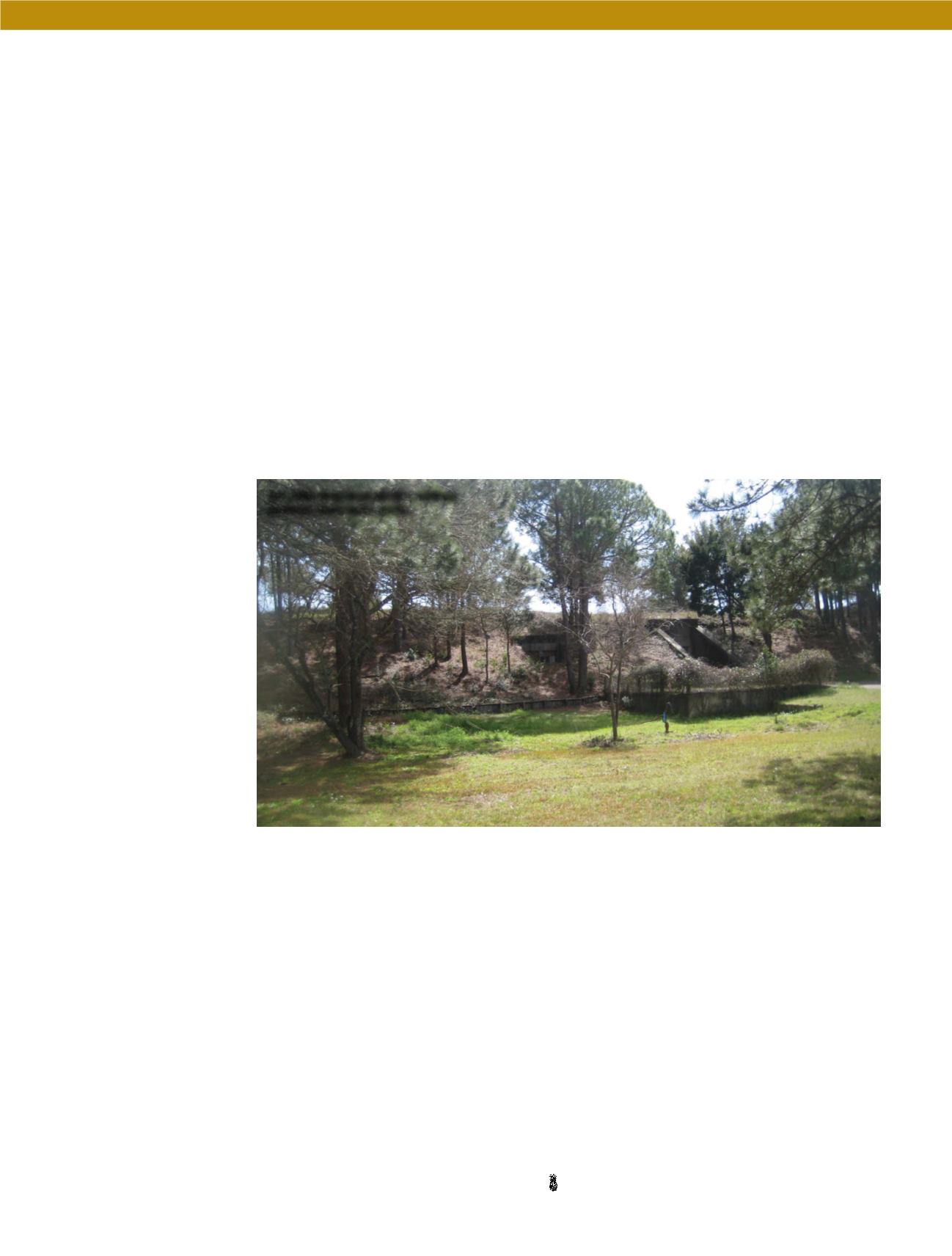
four 155-mm guns on Panama mounts, camouflaged and
hidden among the dunes, as well as two 12-inch casemate-
mounted guns, which were positioned on 700 feet of mov-
able track. The artillery served as protection for the island
and was also used in military drills. Williams explained
that announcements in the Charleston newspaper warned
readers when the guns would be used in exercises so boat-
ers would avoid the area and island residents could take
precautions. He said, “People were even told to open their
windows to reduce the risk of shattering and to wrap their
glass valuables.”
A searchlight measuring 60 inches in diameter was
positioned at Marshall Reservation and coordinated with
other lights in the channel to guard the harbor. The one
at Marshall also protected the island from an amphibious
assault across Breach Inlet, such as the attempt made there
by British forces in 1776. A historical marker at Breach
Inlet describes that Revolutionary War history. Maybe
someday there will be one explaining the importance of
Battery 520 during World War II.
But Williams believes some records probably are still
classified.
The hills that housed the military
bunkers were man-made.